
About
Chapada dos Guimarães National Park is located on the western side of central Brazil. It is approximately the center point for the entire South American continent. The national park encompasses an area of 125.4 square miles (326.18 sq km).
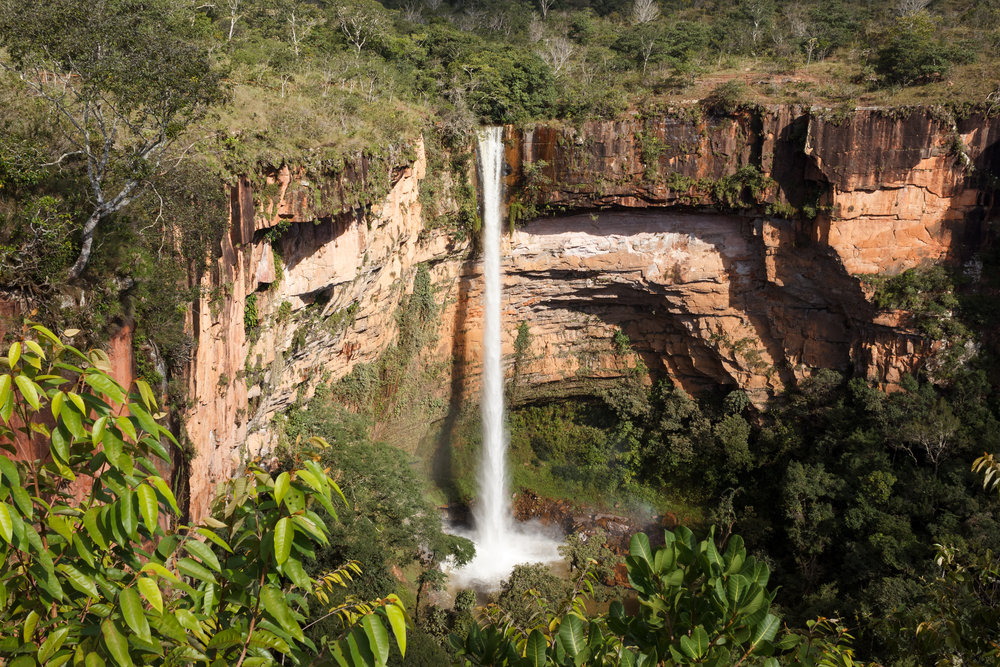
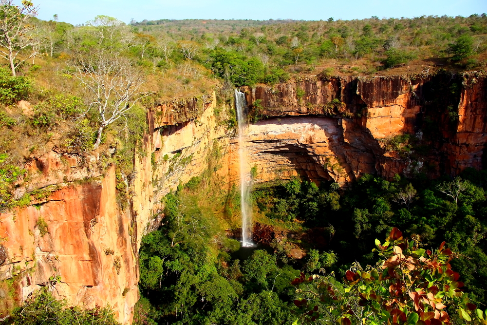
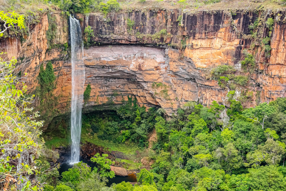
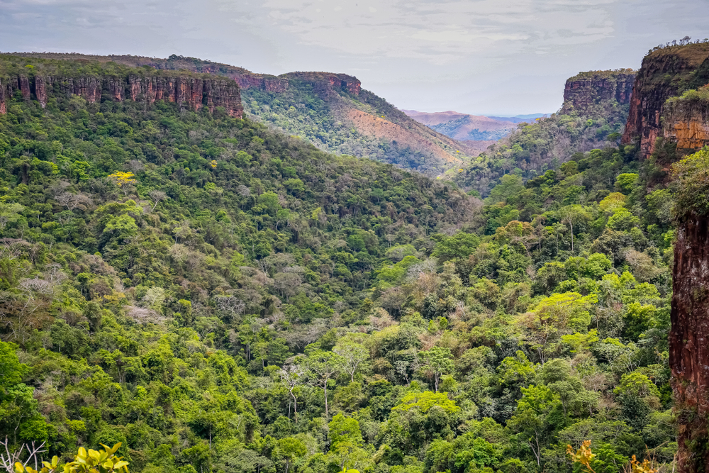
Guimarães is known for its inspiring waterfalls and picturesque cliffs found throughout the rugged landscapes of the park. As part of the larger Pantanal Biosphere Reserve, it is neighbors with Emas National Park, Pantanal Matogrossense National Park, and Serra da Bodoquena National Park.
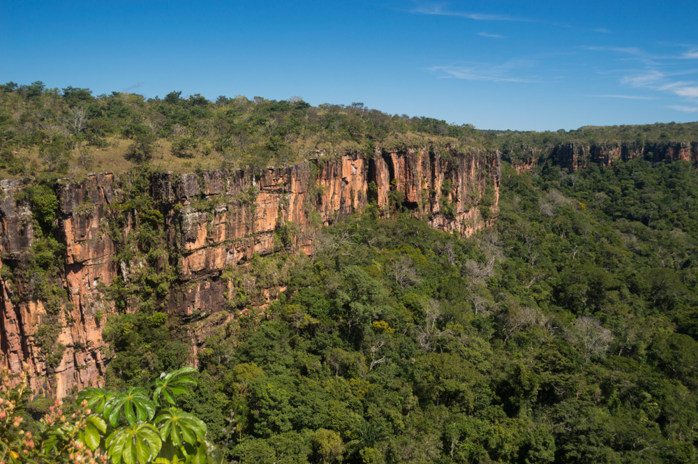
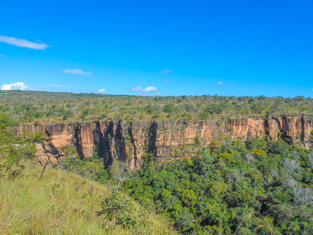
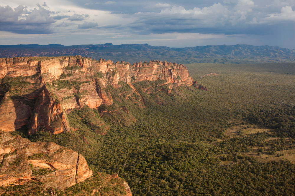
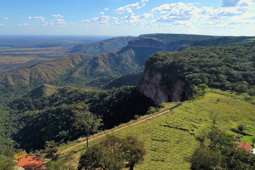
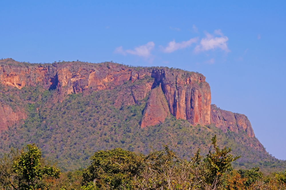
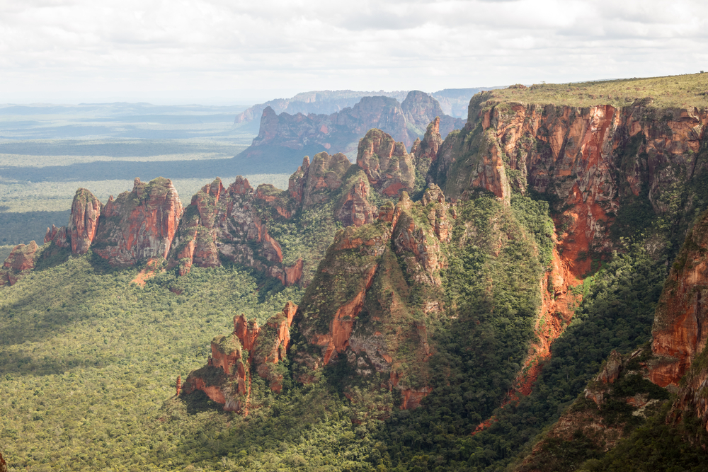
Some would describe the park as similar to the American Southwest with breathtaking rugged red-rock formations, dramatic cliffs, striking waterfalls, and mesmerizing canyons.
The striking red-sandstone cliffs vary in elevation ranging from 2,000 to 2,600 feet (600 to 800m). The Guimarães plateau serves as the foundation of the park and it acts as a transitional divide between the Paraguay and Amazon river basins. Although dry and scrubby vegetation accounts for the majority of vegetation, there are forests and plains that serve as part of the varied habitats. This varied vegetation and higher elevations of the Pantanal ecosystem support an abundance of wildlife.
Some of the more popular exotic species include the maned wolf, the giant anteater, the tapir, and the jaguar. Other species of wildlife include pampas deer, giant armadillo, seriema, greater rhea, and the howler monkey. Bird lovers will appreciate seeing the red macaws, tropical screech-owl, and scissor-tailed nightjar, along with various parrots, and swifts.
There are over 40 archaeological sites that include cave paintings, fossils, and other remnants of history, These historical elements add to the natural beauty of the park.
Photos
Things to See
Things To Do
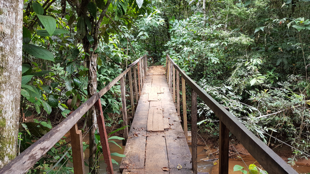
Driving through the park and hiking the various trails are the most commonly engaged activities of the park.

Park Protection
Chapada dos Guimarães National Park was created to protect part of the larger Pantanal ecosystem along with the headwaters of the Cuiaba River which is a primary feeder of the Mato Grosso Pantanal. The national park also protects the abundance of wildlife that live in the varied habitats of the Pantanal.
Sources
- Brazil Nature Tours, Chapada dos Guimaraes, https://www.brazilnaturetours.com/brazil-tours/chapada-dos-guimaraes, retrieved November 1, 2022.
- Brazil Travel Information, The Pantanal Chapada dos Guimaraes, https://www.braziltravelinformation.com/brazil_pantanal_regions_chapadadosguimaraes.htm, retrieved November 2022.
- Tours By Locals, Waterfalls of Chapada dos Guimaraes, https://www.toursbylocals.com/waterfallsway, retrieved November, 2022.
- Wild Brazil, Chapada dos Guimaraes National Park, https://wildbrazil.com.br/cerrado-chapada-guimaraes.php, retrieved November, 2022.
- Wildlife Worldwide, Chapada dos Guimaraes National Park, https://www.wildlifeworldwide.com/locations/chapada-dos-guimaraes-national-park, retried November, 2022.