
About

Masada National Park is located just south of the midway central part of Israel along the eastern border. The national park encompasses an area of just over 1 square mile (2.59 sq km).
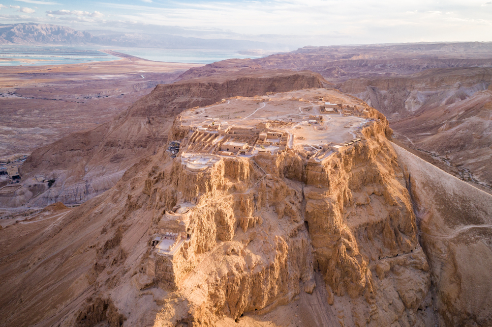
The national park sits atop a plateau along the eastern border of the Judaean Desert. It overlooks the Dead Sea and is one of Israel’s most popular attractions. Masada represents a tremendous blend of culture, history, and nature.
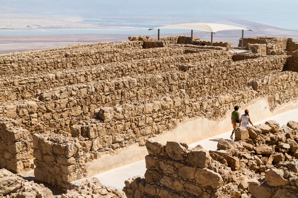
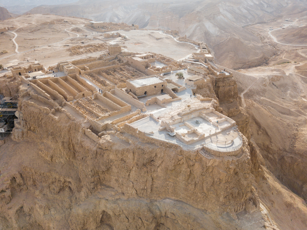
Masada was a historical fortification where Herod the Great constructed two palaces for himself. It was the siege of this fortification during the initial Jewish-Roman War that came close to ending that war.
This was the first place that Herod the Great established as a fortified area after he began ruling over his kingdom.
The fortification was constructed on a horst which is where the plateau ends and is accompanied by sharp cliffs. The cliffs reach a height of 1,300 feet (400 m). The horst area stretches 1,800 feet (550 m) by 890 feet (270 m).
In addition to the steep cliff sides, Herod added a 13-foot (4 m) wall along the plateau. The wall stretched 4,300 feet (1,300 m) around the fortification. He even built his own stepped swimming pool.
Photos


Things to See
Masada National Park Trails
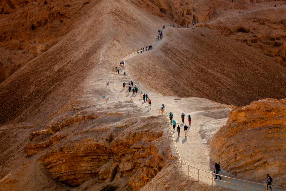
There are two trails that give access to the fortification and both are steep and demanding. Entrance fees are required as well. Either trail is usually started during the early hours of the morning to avoid the higher heats of midday. Hikers are encouraged to take lots of water with them.

Sources
- Dead Sea, Masada National Park, https://www.deadsea.com/explore/historical-sites/archaeological-and-historical-sites/masada-national-park/, retrieved October 2019.
- Go TelAviv, Visit Masada National Park, https://www.go-telaviv.com/masada-national-park.html, retrieved October 2019.
- Israel Opera, Masada National park – A UNESCO World Heritage Site, http://www.israel-opera.co.il/eng/?CategoryID=479, retrieved October 2019.
- Parks Israel, Masada National Park, https://www.parks.org.il/en/reserve-park/masada-national-park/, retrieved October 2019.
- Tourist Israel, Masada Dead Sea, https://www.touristisrael.com/masada-dead-sea/848/, retrieved October 2019.