
About

Hohe Tauern National Park is located in the central part of Austria near the region where the narrow extension begins toward Switzerland. The park covers an area of 716.6 square miles (1,856 sq km), creating the largest national park in the country.
Hohe Tauern National Park is also known as High Tauern National Park. It lies north of the border with Italy and south of the neighboring Berchtesgaden National Park in Germany. Not only is it the country’s largest national park, but it is also the largest protected nature reserve in the Alps.
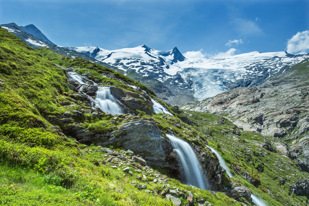
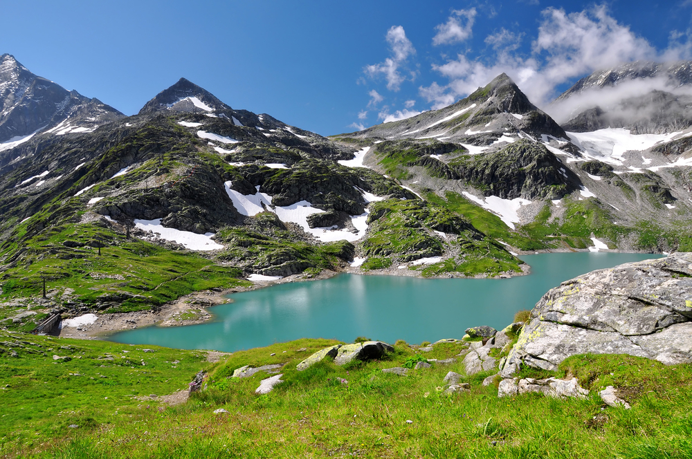
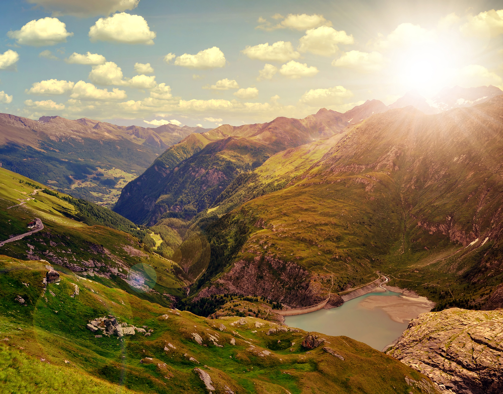
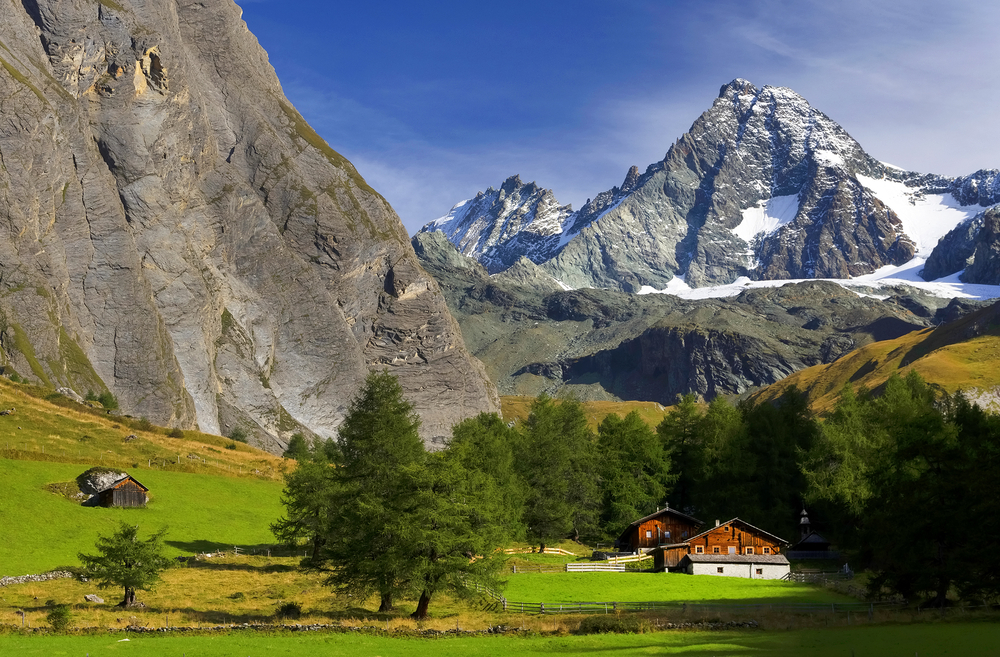
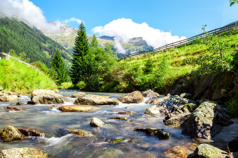
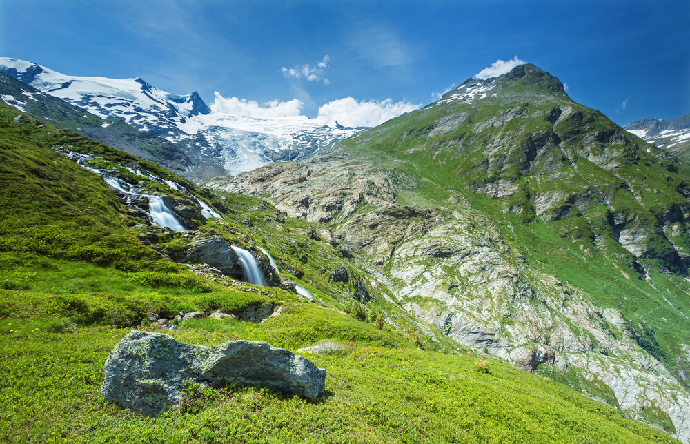
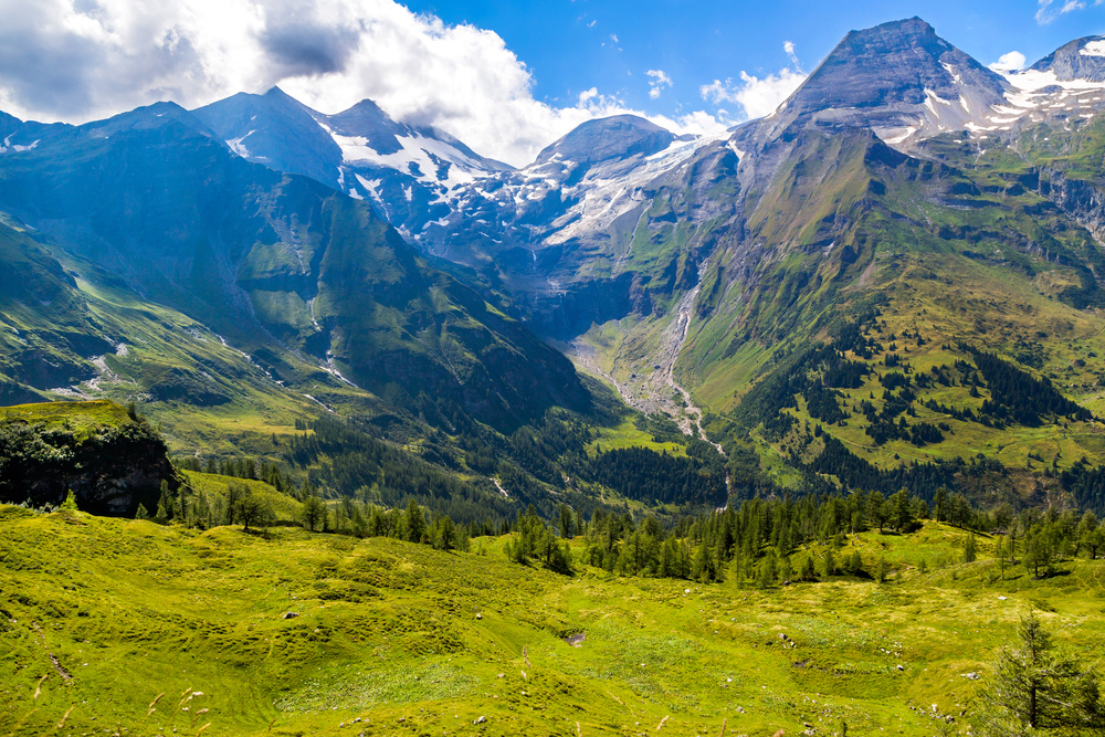
Glacier fields, glacial valleys, mountainous landscapes, alluvial fans, and extensive forests are the natural features of this pristine wilderness. These landscapes and striking mountain summits are easily enjoyed and appreciated while just driving through the many different scenic drives that meander throughout the park’s borders.
The park is divided into four different eco-zones which include montane that is characterized by deciduous, mixed, and spruce forests. The other zones include sub-alpine, alpine, and one of consistent snow known as the nival zone.
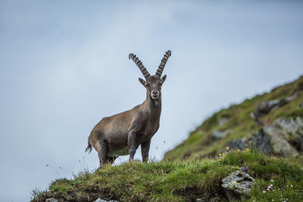
The thick forests, vegetation, and mountainous landscapes create an excellent ecosystem for wildlife in the area. This group of wildlife is affectionately known as the park’s Big 5 and includes ibex, chamois, marmot, golden eagle, and bearded vulture.
Hohe Tauern Highlights
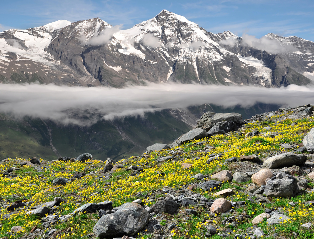
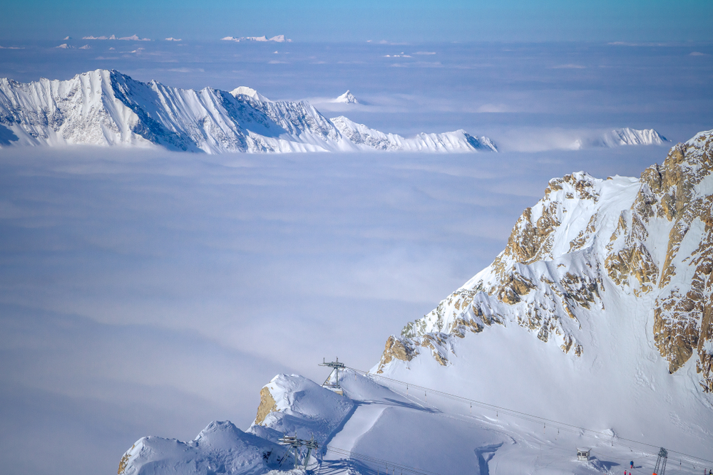
The striking mountainous landscapes and pristine wilderness is the primary attraction of the national park. The abundant rivers, waterfalls, and forests sprawled amongst incredible mountains are a highlight for nature lovers who want to explore the outdoors. The Central Eastern Alps display some of the tallest and most striking peaks. There are multiple mountains with summits reaching over 10,000 feet (3,048 m).
Grossglockner
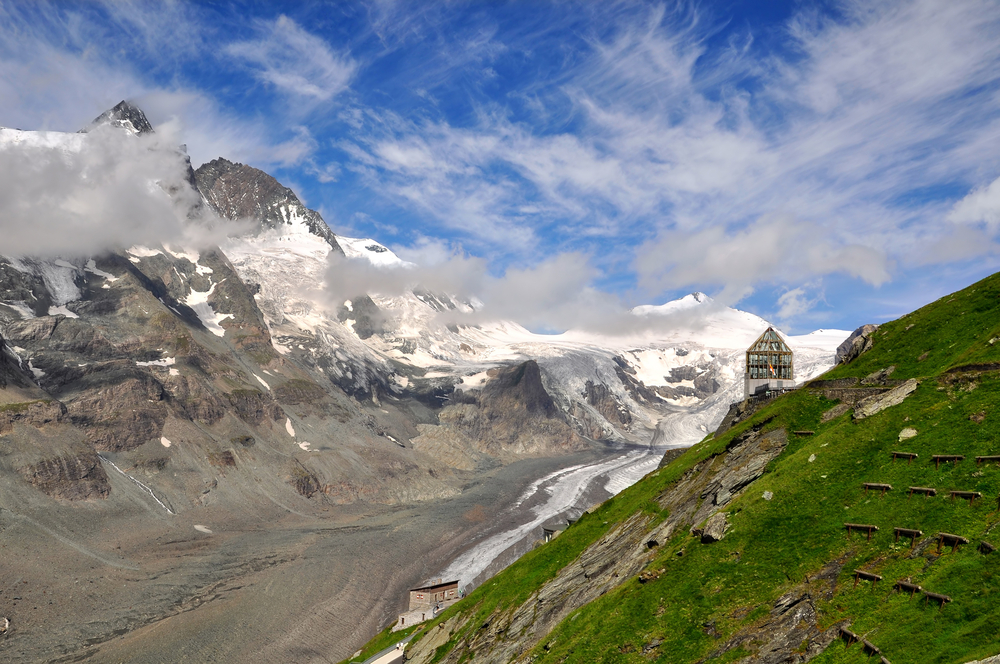
Grossglockner is the tallest summit in Austria reaching a height of 12,461 feet (3,798 m). It is also the tallest summit in the Alps east of the Brenner Pass. Grossglockner peak is the taller of the two pinnacles of the larger mountain with the other being Kleinglockner at 12,370 feet (3,770 m).
Grossglockner is the second tallest mountain in the Alps after Mont Blanc making it one of the most significant summits across the collective European mountain range. It is a coveted mountain for climbers who like reaching the highest summit in each country.
Brenner Pass
Brenner Pass is a scenic drive that traverses along the border of Italy and Austria as it meanders through the Alps. The pass reaches an elevation of 4,495 (1,370 m) making it the lowest alpine pass in the region.
All other passes reach elevations higher than 4,900 feet (1,500 m). The pass delivers stunning views of the valley and surrounding mountain landscape.
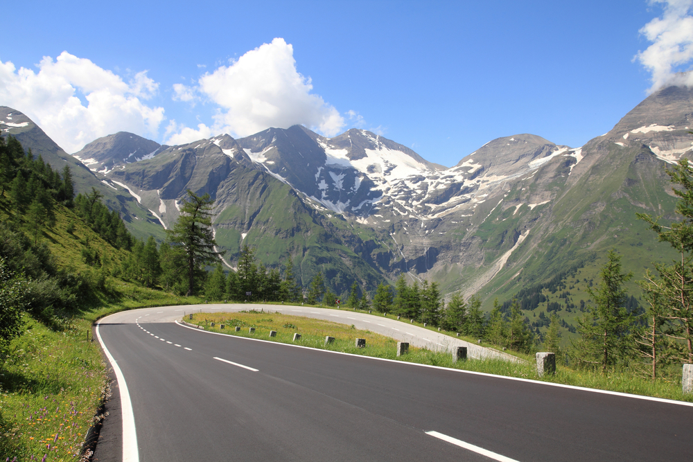
Grossglockner High Alpine Road
The Grossglockner high alpine road is one of the most renowned scenic drives. It features a tunnel at 8,219 feet (2,505 m). The views along the drive are astounding and it delivers excellent views of Grossglockner mountain.
Trails of Hohe Tauern National Park
The park is renowned for scenic landscapes and striking mountains. Driving through the passes and scenic drives is one of the most common activities, however, hiking is the best way to engage the true splendor of this exquisite wilderness.
Alpine Herbs Nature Trail: The mountain meadows are filled with a variety of medicinal herbs. This is an educational outing to witness the presence of these medicinal plants. The loop trail travels through the mountain meadow over a distance of 1.80 miles (2.9 km) while ascending 459.32 feet (140 m). This family-friendly trail is rated easy.
Gamsgrubenweg Trail: This trek ascends 3,041 feet (927 m) through the Alpine terrain over a distance of 6.77 miles (10.9 km). It takes about 6 hours to complete the journey which provides panoramic views of the tallest mountain in Austria, Grossglockner.
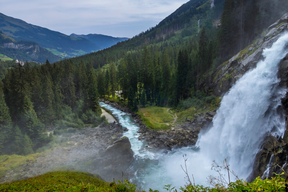
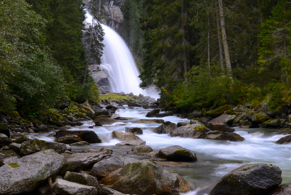
Krimmler Waterfall Trail: This trail is an out and back trek that travels 4.8 miles while ascending 1,453 feet (442.87 m). The trail delivers beautiful landscapes capped off with the 1,246.7 feet (380 m) plunge of Krimmler Waterfall.
Boulder Glacier Trail: This is a trail that is rated moderate while ascending 3,605.6 feet (1,099 m) over a distance of 8.89 miles (14.3 km). The trail delivers bountiful scenic views highlighted by the rock glacier located in the Dosental Valley. This is one of the highlight attractions of the park.
Seebachtal Educational Nature Trail: This magical trail gives way to the stilt roots, praying forest, and ice hole nature attractions that make for a wonderful educational encounter with nature. The trail is rated easy and covers 5.65 miles (9.1 km) while only ascending 492 feet (150 m). It is a loop journey that is family-friendly and takes about 2.5 hours to complete.
Grossglockner Trail: This challenging ascent up the tallest mountain in Austria ascends 5,613 feet (1,710.8 m) while covering a distance of 10.6 miles (17.38 km). The trail is rated difficult but be prepared for incredible panoramic views from the rooftops of Austria. The mountainous landscapes that run as far as the eye can see are astounding.
Park Protection
Hohe Tauern National Park was created to protect one of the most pristine mountainous wildernesses in the Alps. It is the largest protected area within the entire Alps across Europe and the largest national park in Austria.
The primary purpose of the park is to protect the striking mountains and astounding landscapes in the country. The government is committed to ensuring these majestic mountains are available for enjoyment for future Austrians and visitors from around the world.
Photos
Sources
- All Trails, Best Trails in Hohe Tauern National Park, https://www.alltrails.com/parks/austria/carinthia/hohe-tauern-national-park, retrieved September 2020.
- Britannica, Grossglockner, https://www.britannica.com/place/Grossglockner, retrieved September 2020.
- Britannica, Hohe Tauern, https://www.britannica.com/place/Hohe-Tauern, retrieved September 2020.
- Grossglockner, Austria’s Highest View, https://www.grossglockner.at/gg/en/index, retrieved September 2020.
- Hohe Tauern, Park Site, https://www.nationalpark.at/en/, retrieved September 2020.
- Lonely Planet, Welcome to Hohe Tauern National Park, https://www.lonelyplanet.com/austria/tirol/hohe-tauern-national-park, retrieved September 2020.
- National Park Hohe Tauern, Park Site, https://hohetauern.at/en/, retrieved September 2020.
- Summit Post, Grossglockner, https://www.summitpost.org/grossglockner/150224, retrieved September 2020.
- Tyrol, Hohe Tauern National Park, https://www.tyrol.com/things-to-do/attractions/nature-parks/national-park-hohe-tauern, retrieved September 2020.